SurfaceCurrentFeatureInstanceDCF2
- class s100py.s111.v1_2.api.SurfaceCurrentFeatureInstanceDCF2(recursively_create_children=False, **kywrds)
Bases:
FeatureInstanceDCF2,SurfaceCurrentFeatureInstanceBase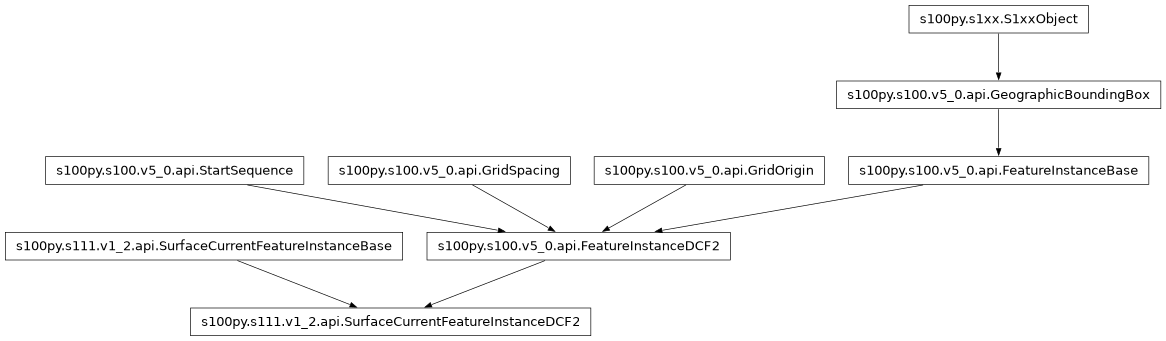
Attributes Summary
DateTime.
DateTime.
Eastern extent
v5.0 Table 10c-11 Structure fo Feature Instance Groups (optional)
The latitude of the grid origin.
Arc Degrees
The grid origin in the vertical dimension.
Cell size in the Y/latitude dimension.
Cell size in the X/longitude dimension.
Cell size in the vertical dimension.
Northern extent
The number of data values groups contained in this instance group
Number of grid points in the Y/latitude dimension.
Number of grid points in the X/longitude dimension.
Number of grid points in the vertical dimension.
The total number of time records.
Southern extent
Grid coordinates of the grid point to which the first in the sequence of values is to be assigned.
Seconds.
Vertical extent of 3-D grids minimumZ, maximumZ: Minimum and maximum values of the grid’s spatial extent along the vertical direction.
Vertical extent of 3-D grids minimumZ, maximumZ: Minimum and maximum values of the grid’s spatial extent along the vertical direction.
Western extent
Methods Summary
add_data(key, value)Creates a value using the first item in the enumeration of data_dynamicity
Creates a blank, empty or zero value for date_time_of_first_record
Creates a blank, empty or zero value for date_time_of_last_record
Gets all the non-standard keys that are contained in this object currently as well as all the standard keys (S100/HDF5 style names) that could be added.
Override this method if the dtype of compound dataset items is important
get_data(key)get_hdf5_from_file(file_obj)get_s1xx_attr(s1xx_name)Returns the S100 (HDF5) names for the things that are listed in the specs for this class.
Returns a list of properties that are lists (children based on S1xxCollection).
This function autodetermines the properties implemented (which have get/set @properties and _hdf_name associated)
This function autodetermines the HDF5 or xml names and their associated property names.
Override this method if the data types of attributes/groups/dataset items is important
Override this method if the write order of attributes/groups/dataset items is important
Creates a blank, empty or zero value for grid_origin_latitude
Creates a blank, empty or zero value for grid_origin_longitude
Creates a blank, empty or zero value for grid_origin_vertical
Creates a blank, empty or zero value for grid_spacing_latitudinal
Creates a blank, empty or zero value for grid_spacing_longitudinal
Creates a blank, empty or zero value for grid_spacing_vertical
initialize_properties([...])Calls the create function for all the properties of the class.
Creates a blank, empty or zero value for num_grp
Creates a blank, empty or zero value for num_points_latitudinal
Creates a blank, empty or zero value for num_points_longitudinal
Creates a blank, empty or zero value for num_points_vertical
Creates a blank, empty or zero value for number_of_times
read(group_object)Given an h5py.File or a h5py group then read the data based on the encoded S100+ spec.
read_simple_attributes(group_object)Reads the standard simple types (strings, ints, floats, datetimes, enums) from the given group as specified by the class specs.
set_datetime_attribute(val, hdf_name, date_type)set_enum_attribute(val, hdf_name, enum_type)Function to set an attribute that is an enumeration type using either it's string or numeric value or enumeration instance.
set_s1xx_attr(s1xx_name, val)Creates a blank, empty or zero value for start_sequence
Creates a blank, empty or zero value for time_record_interval
Creates a blank, empty or zero value for vertical_extent_maximum_z
Creates a blank, empty or zero value for vertical_extent_minimum_z
write(hdf5_object)write the contained data and all it's children into an HDF5 file using h5py.
write_as_xml(etree_object)write_simple_attributes(group_object)Attributes Documentation
- data_dynamicity
- date_time_of_first_record
DateTime. Time series data only
- Type:
The validity time of the earliest time record. Units
- date_time_of_last_record
DateTime. Time series data only
- Type:
The validity time of the latest time record. Units
- east_bound_longitude
Eastern extent
- extent
v5.0 Table 10c-11 Structure fo Feature Instance Groups (optional)
From 4.2.1.1.1.12, The attribute extent has the value class CV_GridEnvelope that shall contain the extent of the spatial domain of the coverage. It uses the value class CV_GridEnvelope which provides the grid coordinate values for the diametrically opposed corners of the grid. The default is that this value is derived from the bounding box for the data set or tile in a multi tile data set
- extent_dtype
- grid_origin_latitude
The latitude of the grid origin. Arc Degrees
- grid_origin_longitude
Arc Degrees
- Type:
The longitude of the grid origin. Unit
- grid_origin_vertical
The grid origin in the vertical dimension. Only for 3-D grids. Units specified by product specifications
- grid_spacing_latitudinal
Cell size in the Y/latitude dimension. This is the Y/latitudinal component of the offset vector (8-7.1.4). Units: Arc Degrees
- grid_spacing_longitudinal
Cell size in the X/longitude dimension. This is the X/longitudinal component of the offset vector (8-7.1.4). Units: Arc Degrees
- grid_spacing_vertical
Cell size in the vertical dimension. Only for 3-D grids. Units specified by product specifications.
- north_bound_latitude
Northern extent
- num_grp
The number of data values groups contained in this instance group
- num_points_latitudinal
Number of grid points in the Y/latitude dimension. (jMax)
- num_points_longitudinal
Number of grid points in the X/longitude dimension. (iMax)
- num_points_vertical
Number of grid points in the vertical dimension. (kMax)
- number_of_times
The total number of time records. Time series data only
- south_bound_latitude
Southern extent
- start_sequence
Grid coordinates of the grid point to which the first in the sequence of values is to be assigned. The choice of a valid point for the start sequence is determined by the sequencing rule. Format: n, n… (comma-separated list of grid points, one per dimension – For example, 0,0)
- surface_current_group
- time_record_interval
Seconds. Time series data only
- Type:
The interval between time records. Units
- uncertainty_dataset
- vertical_extent_maximum_z
Vertical extent of 3-D grids minimumZ, maximumZ: Minimum and maximum values of the grid’s spatial extent along the vertical direction. They are encoded as separate attributes
- vertical_extent_minimum_z
Vertical extent of 3-D grids minimumZ, maximumZ: Minimum and maximum values of the grid’s spatial extent along the vertical direction. They are encoded as separate attributes
- west_bound_longitude
Western extent
Methods Documentation
- add_data(key, value)
- data_dynamicity_create()
Creates a value using the first item in the enumeration of data_dynamicity
- date_time_of_first_record_create()
Creates a blank, empty or zero value for date_time_of_first_record
- date_time_of_last_record_create()
Creates a blank, empty or zero value for date_time_of_last_record
- east_bound_longitude_create()
- extent_create()
- get_all_keys()
Gets all the non-standard keys that are contained in this object currently as well as all the standard keys (S100/HDF5 style names) that could be added.
- Return type:
list
- get_compound_dtype()
Override this method if the dtype of compound dataset items is important
- Return type:
A list of dtype, None otherwise.
- get_data(key)
- get_hdf5_from_file(file_obj)
- get_s1xx_attr(s1xx_name)
- get_standard_keys()
Returns the S100 (HDF5) names for the things that are listed in the specs for this class.
- Returns:
The S102 HDF5 group/attribute/dataset names from this object that will be written or read from an HDF5 file. e.g. BathymetryCoverage or westBoundLongitude etc.
For the class “Root”: [‘BathymetryCoverage’, ‘Group_F’, ‘TrackingListCoverage’]
- Return type:
list
- get_standard_list_properties()
Returns a list of properties that are lists (children based on S1xxCollection). Basically a way of finding which items will be named <name>_001, <name>_002 etc
- Returns:
The property names that will have auto-generated names based on their index in a list.
- Return type:
list
- classmethod get_standard_properties()
This function autodetermines the properties implemented (which have get/set @properties and _hdf_name associated)
- Returns:
Names of the properties implemented.
For eample class “Root” might have (for S102): [‘bathymetry_coverage’, ‘feature_information’, ‘tracking_list_coverage’]
- Return type:
list
- get_standard_properties_mapping()
This function autodetermines the HDF5 or xml names and their associated property names. Keys are the s100 (HDF5 spelling) strings and the values are the python style naming.
- Returns:
dictionary of xml element names as keys and property names as values.
For the class “Root”: {‘BathymetryCoverage’: ‘bathymetry_coverage’, ‘Group_F’: ‘feature_information’, ‘TrackingListCoverage’: ‘tracking_list_coverage’}
- Return type:
dict
- get_write_dtypes()
Override this method if the data types of attributes/groups/dataset items is important
- Return type:
A list of tuples having key names and type, None otherwise.
- get_write_order()
Override this method if the write order of attributes/groups/dataset items is important
- Return type:
A list of key names if order is important, None otherwise.
- grid_origin_latitude_create()
Creates a blank, empty or zero value for grid_origin_latitude
- grid_origin_longitude_create()
Creates a blank, empty or zero value for grid_origin_longitude
- grid_origin_vertical_create()
Creates a blank, empty or zero value for grid_origin_vertical
- grid_spacing_latitudinal_create()
Creates a blank, empty or zero value for grid_spacing_latitudinal
- grid_spacing_longitudinal_create()
Creates a blank, empty or zero value for grid_spacing_longitudinal
- grid_spacing_vertical_create()
Creates a blank, empty or zero value for grid_spacing_vertical
- initialize_properties(recursively_create_children=False, overwrite=True)
Calls the create function for all the properties of the class. Default values will be created for each attribute that is expected to be contained in this object.
For example, say a class has simple attributes of ESPG code (int) and locatilty (str) and then a class made from S1xxObject called “extents” which has east and west inside it.
Calling initialize_properties(recursively_create_children=False) would result in EPSG=0, locality=”” and an instance of the “extents” class but NO value (nothing would be written to HDF5) for east, west.
Calling initialize_properties(recursively_create_children=True) would result in EPSG=0, locality=”” and an instance of the “extents” class but with east=0.0 and wesst=0.0 as well.
Calling initialize_properties(recursively_create_children=True, overwrite=False) with an esiting dataset, say locality=”test” would result in EPSG=0 being made, locality=”test” being retained and an instance of the “extents” class with east=0.0 and wesst=0.0 as well.
- Parameters:
recursively_create_children – True = Create children for any child data that would have other children False = Only create data for immediate children of this instance
overwrite – True = Overwrite existing data with new default data False = Keep existing data if it exists but create new data otherwise
- Return type:
None
- north_bound_latitude_create()
- num_grp_create()
Creates a blank, empty or zero value for num_grp
- num_points_latitudinal_create()
Creates a blank, empty or zero value for num_points_latitudinal
- num_points_longitudinal_create()
Creates a blank, empty or zero value for num_points_longitudinal
- num_points_vertical_create()
Creates a blank, empty or zero value for num_points_vertical
- number_of_times_create()
Creates a blank, empty or zero value for number_of_times
- read(group_object)
Given an h5py.File or a h5py group then read the data based on the encoded S100+ spec.
- Parameters:
group_object – The group (an h5py.File is a group too) to read from.
- Return type:
None
- read_simple_attributes(group_object)
Reads the standard simple types (strings, ints, floats, datetimes, enums) from the given group as specified by the class specs.
- Parameters:
group_object – The group (an h5py.File is a group too) to read from.
- Return type:
None
- set_datetime_attribute(val, hdf_name, date_type)
- set_enum_attribute(val, hdf_name, enum_type)
Function to set an attribute that is an enumeration type using either it’s string or numeric value or enumeration instance. Raises an ValueError if the value is not found.
- Parameters:
val – The value as a string, int or Enum().
hdf_name – The S100 name (hdf5 spelling).
enum_type – The class of enumeration to use if an instance needs to be created.
- Return type:
None
- set_s1xx_attr(s1xx_name, val)
- south_bound_latitude_create()
- start_sequence_create()
Creates a blank, empty or zero value for start_sequence
- surface_current_group_create()
- time_record_interval_create()
Creates a blank, empty or zero value for time_record_interval
- uncertainty_dataset_create()
- vertical_extent_maximum_z_create()
Creates a blank, empty or zero value for vertical_extent_maximum_z
- vertical_extent_minimum_z_create()
Creates a blank, empty or zero value for vertical_extent_minimum_z
- west_bound_longitude_create()
- write(hdf5_object)
write the contained data and all it’s children into an HDF5 file using h5py.
- Parameters:
group_object – An h5py.File or an h5py group object
- Return type:
None
- write_as_xml(etree_object)
- write_simple_attributes(group_object)
- __init__(recursively_create_children=False, **kywrds)